Skip to content
La Via delle Malghe | Altopiano dei Sette Comuni
#sweethomealtopiano
La Via delle Malghe | Altopiano dei Sette ComuniLa Via delle Malghe | Altopiano dei Sette Comuni
  • Home
  • Project
    • The project “The Malga Trail”
    • Press conference and Press kit
    • The Malga: history, environment, territory, management
    • Tourist accomodations in the Malga: good practices
    • Orientwalking among the malgas
    • Interview with Gianbattista Rigoni Stern
  • Malgas
  • Itineraries
    • All itineraries
    • A | Between Biancoia and Monte Corno
      • A1 | Val Biancoia and surrounding areas
      • A2 | Bertiaga – Valle Camporossignolo – Valle Granezza di Gallio – Monte Corno
      • A3 | Monte Corno – Campo Rossignolo
    • B | The Three Mountains
      • B1 | Cima Ekar – Monte Valbella – Bertigo – Turcio
      • B2 | Valbella – Cima Ekar
    • C | Melette of Foza and Gallio
      • C1 | Trail around Melette of Foza and Gallio by bike
      • C2 | Melette of Foza walking trail
    • D | Piana di Marcesina, Valmaron and Ortigara
      • D1 | Valmaron – Marcesina – Lozze – Fiara
      • D2 | Marcesina – Lozze – Fiara
      • D3 | Valmaron and Marcesina with road bikes
      • D4 | Valmaron – Forcellona – Marcesina
    • E | Along the ridge of Longara
      • E1 | Longara and Campomulo
    • F | Monte Zebio, in the heart of the Plateau
      • F1 | Forte Interrotto – Val Galmarara – Zingarella – Zebio – Val di Nos
      • F2 | Zebio and Zingarella
    • G | Facing Cima Portule
      • G1 | Larici – Portule – Galmarara
    • H | The high pastures of Larici
      • H1 | Val Formica, Dosso and Porta Manazzo
    • I | On the slopes of Monte Verena
      • I1 | Roana Lake – Verena – Campolongo
      • I2 | Monte Verena trail
      • I3 | Ghertele Ecological Museum
      • I4 | Rotzo Malgas trail
    • L | A window onto the plain
      • L1 | Asiago – Val Magnaboschi – Monte Paù – Monte Corno
      • L2 | Buse di Carriola – Bocchetta Paù – Foraoro
    • Other itineraries on the Plateau: the “Alta Via della Grande Guerra”
  • Services
    • Tourist information
    • E-bike recharge – Rental and purchase spots
    • Winter sports
    • GPS route
    • Webcam
  • Contacts
  • Italian
  • German
  • Home
  • Project
    • The project “The Malga Trail”
    • Press conference and Press kit
    • The Malga: history, environment, territory, management
    • Tourist accomodations in the Malga: good practices
    • Orientwalking among the malgas
    • Interview with Gianbattista Rigoni Stern
  • Malgas
  • Itineraries
    • All itineraries
    • A | Between Biancoia and Monte Corno
      • A1 | Val Biancoia and surrounding areas
      • A2 | Bertiaga – Valle Camporossignolo – Valle Granezza di Gallio – Monte Corno
      • A3 | Monte Corno – Campo Rossignolo
    • B | The Three Mountains
      • B1 | Cima Ekar – Monte Valbella – Bertigo – Turcio
      • B2 | Valbella – Cima Ekar
    • C | Melette of Foza and Gallio
      • C1 | Trail around Melette of Foza and Gallio by bike
      • C2 | Melette of Foza walking trail
    • D | Piana di Marcesina, Valmaron and Ortigara
      • D1 | Valmaron – Marcesina – Lozze – Fiara
      • D2 | Marcesina – Lozze – Fiara
      • D3 | Valmaron and Marcesina with road bikes
      • D4 | Valmaron – Forcellona – Marcesina
    • E | Along the ridge of Longara
      • E1 | Longara and Campomulo
    • F | Monte Zebio, in the heart of the Plateau
      • F1 | Forte Interrotto – Val Galmarara – Zingarella – Zebio – Val di Nos
      • F2 | Zebio and Zingarella
    • G | Facing Cima Portule
      • G1 | Larici – Portule – Galmarara
    • H | The high pastures of Larici
      • H1 | Val Formica, Dosso and Porta Manazzo
    • I | On the slopes of Monte Verena
      • I1 | Roana Lake – Verena – Campolongo
      • I2 | Monte Verena trail
      • I3 | Ghertele Ecological Museum
      • I4 | Rotzo Malgas trail
    • L | A window onto the plain
      • L1 | Asiago – Val Magnaboschi – Monte Paù – Monte Corno
      • L2 | Buse di Carriola – Bocchetta Paù – Foraoro
    • Other itineraries on the Plateau: the “Alta Via della Grande Guerra”
  • Services
    • Tourist information
    • E-bike recharge – Rental and purchase spots
    • Winter sports
    • GPS route
    • Webcam
  • Contacts
  • Italian
  • German

The high pastures of Larici

You are here:
  1. Home
  2. The high pastures of Larici
Plateau area: Larici – Manazzo

Group of itineraries: H

See itineraries in GOOGLE MAPS
Google Maps
MAPS with all itineraries
Download

Plateau area: Larici – Manazzo

Group of itineraries: H

See itineraries in GOOGLE MAPS
Google Maps
MAPS with all itineraries
Download

ITINERARY H1
Val Formica, Dosso and Porta Manazzo

Length: 7,44 km
Difference in elevation: 190 m
Difficulty: Intermediate

Suitable for beginners/families
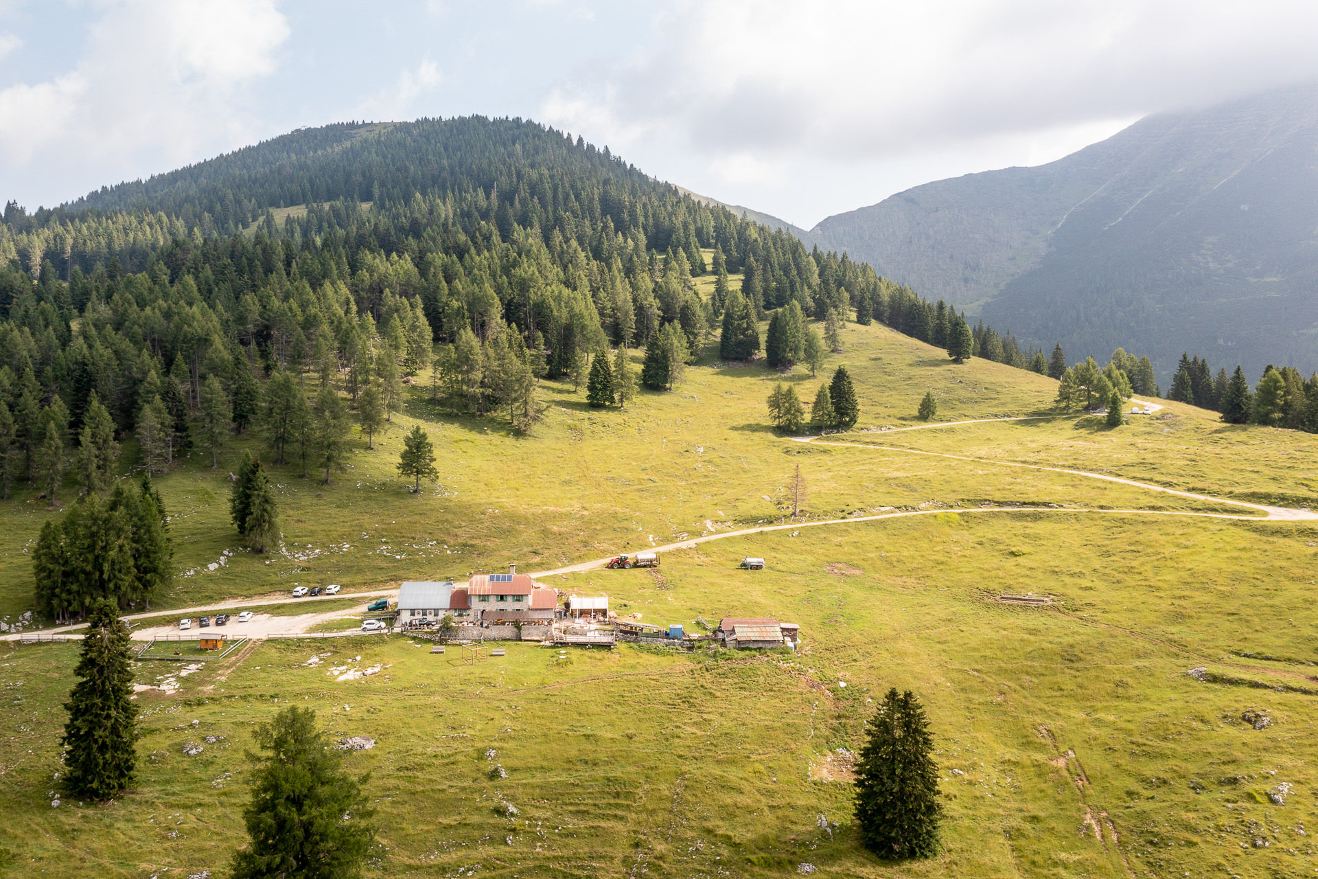
Itinerary that winds through the north west part of the Plateau, near the Trentino border, through extremely scenic forests and pastures. Although it runs at a medium-high altitude, the overall difference in level is contained, so much that it makes this excursion suitable even for the less experienced. Along the entire itinerary, there is a beautiful view of the Cima Portule ridge and from Porta Manazzo, one can see all the way to the Trentino-Alto Adige Alps and the Dolomites…
For information, GPS routes and malgas along the path:

Find out more

Tourist spots in the surrounding areas

Equipped areas and services

  • Rifugio Val Formica
  • Rifugio Larici

Environmental and landscaping

  • Cima Larici
  • Porta Manazzo
  • Cima Portule

Buildings, Monuments, and Museums

  • Remains of tunnels and observation points from the Great War (visible in Porta Manazzo)
Other itineraries/sites nearby
  • CAI 826 Cima Portule Trail
  • SAT / E205 – Cima Manderiolo and return

Winter sports nearby

  • Val Formica Ski Area
  • Ideal area for snowshoe and ski mountaineering excursions
Find out more
Other itineraries/sites nearby
  • CAI 826 Cima Portule Trail
  • SAT / E205 – Cima Manderiolo and return

Winter sports nearby

  • Val Formica Ski Area
  • Ideal area for snowshoe and ski mountaineering excursions
Find out more
I pascoli alti dei Larici - The high pastures of Larici - Die Hochweiden von Larici


  • Home
  • The project
  • Press conference and Press kit
  • Malgas
  • Itineraries
  • Contacts
  • Home
  • The project
  • Press conference and Press kit
  • Malgas
  • Itineraries
  • Contacts

Initiative financed by the Veneto rural development program 2014-2020
Authority responsible for information: Unione Montana Spettabile Reggenza dei Sette Comuni
Managing authority: Regione del Veneto – Direzione AdG FEASR Bonifica e Irrigazione

logo_reggenza2
regione-veneto
GAL_500
Facebook Instagram Youtube

© Unione Montana Spettabile Reggenza dei Sette Comuni ASIAGO ENEGO FOZA GALLIO LUSIANA CONCO ROANA ROTZO
Piazza Stazione – 36012 Asiago (VI) – All rights reserved – Cookie Policy | Privacy Policy | Website by Veneto Marketing

Go to Top