Skip to content
La Via delle Malghe | Altopiano dei Sette Comuni
#sweethomealtopiano
La Via delle Malghe | Altopiano dei Sette ComuniLa Via delle Malghe | Altopiano dei Sette Comuni
  • Home
  • Project
    • The project “The Malga Trail”
    • Press conference and Press kit
    • The Malga: history, environment, territory, management
    • Tourist accomodations in the Malga: good practices
    • Orientwalking among the malgas
    • Interview with Gianbattista Rigoni Stern
  • Malgas
  • Itineraries
    • All itineraries
    • A | Between Biancoia and Monte Corno
      • A1 | Val Biancoia and surrounding areas
      • A2 | Bertiaga – Valle Camporossignolo – Valle Granezza di Gallio – Monte Corno
      • A3 | Monte Corno – Campo Rossignolo
    • B | The Three Mountains
      • B1 | Cima Ekar – Monte Valbella – Bertigo – Turcio
      • B2 | Valbella – Cima Ekar
    • C | Melette of Foza and Gallio
      • C1 | Trail around Melette of Foza and Gallio by bike
      • C2 | Melette of Foza walking trail
    • D | Piana di Marcesina, Valmaron and Ortigara
      • D1 | Valmaron – Marcesina – Lozze – Fiara
      • D2 | Marcesina – Lozze – Fiara
      • D3 | Valmaron and Marcesina with road bikes
      • D4 | Valmaron – Forcellona – Marcesina
    • E | Along the ridge of Longara
      • E1 | Longara and Campomulo
    • F | Monte Zebio, in the heart of the Plateau
      • F1 | Forte Interrotto – Val Galmarara – Zingarella – Zebio – Val di Nos
      • F2 | Zebio and Zingarella
    • G | Facing Cima Portule
      • G1 | Larici – Portule – Galmarara
    • H | The high pastures of Larici
      • H1 | Val Formica, Dosso and Porta Manazzo
    • I | On the slopes of Monte Verena
      • I1 | Roana Lake – Verena – Campolongo
      • I2 | Monte Verena trail
      • I3 | Ghertele Ecological Museum
      • I4 | Rotzo Malgas trail
    • L | A window onto the plain
      • L1 | Asiago – Val Magnaboschi – Monte Paù – Monte Corno
      • L2 | Buse di Carriola – Bocchetta Paù – Foraoro
    • Other itineraries on the Plateau: the “Alta Via della Grande Guerra”
  • Services
    • Tourist information
    • E-bike recharge – Rental and purchase spots
    • Winter sports
    • GPS route
    • Webcam
  • Contacts
  • Italian
  • German
  • Home
  • Project
    • The project “The Malga Trail”
    • Press conference and Press kit
    • The Malga: history, environment, territory, management
    • Tourist accomodations in the Malga: good practices
    • Orientwalking among the malgas
    • Interview with Gianbattista Rigoni Stern
  • Malgas
  • Itineraries
    • All itineraries
    • A | Between Biancoia and Monte Corno
      • A1 | Val Biancoia and surrounding areas
      • A2 | Bertiaga – Valle Camporossignolo – Valle Granezza di Gallio – Monte Corno
      • A3 | Monte Corno – Campo Rossignolo
    • B | The Three Mountains
      • B1 | Cima Ekar – Monte Valbella – Bertigo – Turcio
      • B2 | Valbella – Cima Ekar
    • C | Melette of Foza and Gallio
      • C1 | Trail around Melette of Foza and Gallio by bike
      • C2 | Melette of Foza walking trail
    • D | Piana di Marcesina, Valmaron and Ortigara
      • D1 | Valmaron – Marcesina – Lozze – Fiara
      • D2 | Marcesina – Lozze – Fiara
      • D3 | Valmaron and Marcesina with road bikes
      • D4 | Valmaron – Forcellona – Marcesina
    • E | Along the ridge of Longara
      • E1 | Longara and Campomulo
    • F | Monte Zebio, in the heart of the Plateau
      • F1 | Forte Interrotto – Val Galmarara – Zingarella – Zebio – Val di Nos
      • F2 | Zebio and Zingarella
    • G | Facing Cima Portule
      • G1 | Larici – Portule – Galmarara
    • H | The high pastures of Larici
      • H1 | Val Formica, Dosso and Porta Manazzo
    • I | On the slopes of Monte Verena
      • I1 | Roana Lake – Verena – Campolongo
      • I2 | Monte Verena trail
      • I3 | Ghertele Ecological Museum
      • I4 | Rotzo Malgas trail
    • L | A window onto the plain
      • L1 | Asiago – Val Magnaboschi – Monte Paù – Monte Corno
      • L2 | Buse di Carriola – Bocchetta Paù – Foraoro
    • Other itineraries on the Plateau: the “Alta Via della Grande Guerra”
  • Services
    • Tourist information
    • E-bike recharge – Rental and purchase spots
    • Winter sports
    • GPS route
    • Webcam
  • Contacts
  • Italian
  • German

D4 | Valmaron – Forcellona – Marcesina

You are here:
  1. Home
  2. Itineraries
  3. D4 | Valmaron – Forcellona – Marcesina
Piana di Marcesina, Valmaron e Ortigara - Piana di Marcesina, Valmaron and Ortigara - Ebene von Marcesina, Valmaron und Ortigara

Group of itineraries

Piana di Marcesina, Valmaron and Ortigara

  • Description
  • Additional information
Description

Description

Ideal: on foot
Length: 10,4 km
Average duration: 02:52
Difference in elevation: 180 m
Difficulty: intermediate
Data collected through Komoot App, “HIKING” mode
Starting point/Arrival: Valmaron
Recommended direction : Counter-clockwise
Ideal season for trekking: da maggio a ottobre


Starting point at Rifugio Valmaron. Go past the parking lot behind the cross-country skiing trails starting point and go towards the north trail that moves through the valley bottom and then uphill on the left to Passo della Forcellona. Once you have gone through the pass, go downhill until you reach the asphalted road that crosses the central area of Piana di Marcesina. Then turn left, passing among the malgas of the Piana. At the next two forks turn left and then follow the asphalted road that takes you to Valmaron locality.


Additional information

Additional information

Plateau area/s

Marcesina – Ortigara

Discipline

Ideal on foot

Difficulty

Suitable for beginners/families, Intermediate

Length (on foot)

from 7 to 12 km

Difference in elevation (on foot)

up to 200 m

General information and news

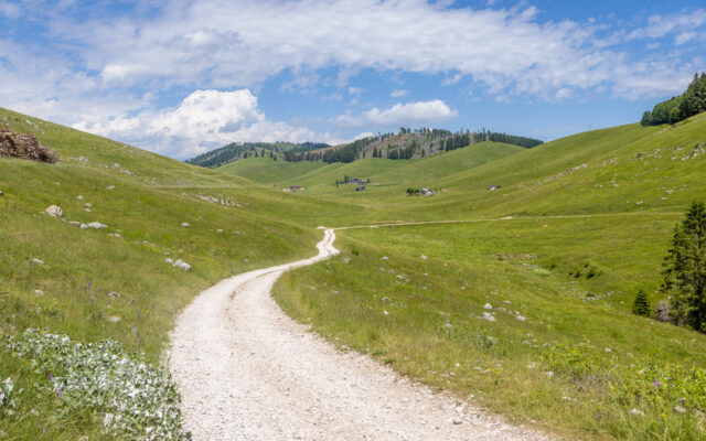
Looping itinerary that allows you to approach the Piana di Marcesina and the numerous malgas of the area through a scenic route with particularly interesting views from the Passo della Forcellona. The route, suitable for all, is primarily flat after the brief initial ascent.
The Piana di Marcesina, renowned for exceptionally cold winter temperatures due to its particular position and morphological conformation, is an extremely interesting area from an environmental, landscape, and historical point of view.
Despite the damage caused in 2018 by the strong winds of the Vaia Storm, vast spruce forests still characterize the Nordic type landscape of the Piana di Marcesina and the Valmaron, providing spectacular views.


Mountains in the area: Monte della Forcellona.

Photos, videos, tourist spots in the surrounding areas

Find out more

Tips for making the most of the trail

Ideal: on foot
Length: 10,4 km
Average duration: 02:52
Difference in elevation: 180 m
Difficulty: intermediate
Data collected through Komoot App, “HIKING” mode
Starting point/Arrival: Valmaron
Recommended direction : Counter-clockwise
Ideal season for trekking: da maggio a ottobre


Starting point at Rifugio Valmaron. Go past the parking lot behind the cross-country skiing trails starting point and go towards the north trail that moves through the valley bottom and then uphill on the left to Passo della Forcellona. Once you have gone through the pass, go downhill until you reach the asphalted road that crosses the central area of Piana di Marcesina. Then turn left, passing among the malgas of the Piana. At the next two forks turn left and then follow the asphalted road that takes you to Valmaron locality.


WOULD YOU LIKE TO USE THE GPS NAVIGATOR?​

Download .GPX

The circular route track is available in .gpx format as well
> Find out more about how to use GPS tracks

> E-bike recharge stations – Rental and purchase spots for bikes, e-bikes, clothing and equipment

Possible customizations and alternate starting points​

  • The proposed itineraries are planned in a circular fashion, thus the starting point coincides with the destination point.
  • The travel direction indicated here is recommended based on the itinerary’s altitude and to facilitate the overall panoramic view.
  • In case of customizations, we recommend you check the changes in parameters regarding the length, travel time and the altitude differences, as well as to ascertain the actual practicability of the trails that are not mentioned here.

This itinerary is easily accessible by following an approaching path from the center of the Seven Municipalities of the Altopiano or from particularly convenient points due to their geographical position or services offered.

Alternative starting points/arrivals in the area:

Rifugio Marcesina (arriving from Foza)

Malgas that can be reached during the itinerary

We recommend to checking the periods when the services offered by the malgas are available (usually June-September, but with varying dates)

Along the trail/nearby:

Malga Valmaron – II lotto

Codice ID: 44

Attività e servizi: 

Summer pasturing
Milking

Scopri di più
Malga Marcesina – V lotto

Codice ID: 39

Attività e servizi: 

Summer pasturing
Milking

Scopri di più
Malga Marcesina – IV lotto

Codice ID: 38

Attività e servizi: 

Summer pasturing
Milking

Scopri di più
Malga Marcesina – III lotto

Codice ID: 37

Attività e servizi: 

Summer pasturing
Milking

Scopri di più
Malga Marcesina – II lotto

Codice ID: 36

Attività e servizi: 

Summer pasturing
Milking
Cheese-making
Production/sales of malga products
Families with children welcome

Scopri di più
Malga Marcesina – I lotto

Codice ID: 35

Attività e servizi: 

Summer pasturing

Coming soon:
Milking
Production/sales of malga products

Scopri di più
Malga Valmaron – III lotto

Codice ID: 45

Attività e servizi: 

Summer pasturing
Milking
Cheese-making
Production/sales of malga products
Food/drink service
Families with children welcome

Scopri di più

Reachable with a brief detour:

Malga Marcesina di sopra

Codice ID: 40

Attività e servizi: 

Summer pasturing
Milking

Scopri di più
Malga Campocavallo

Codice ID: 34

Attività e servizi: 

Summer pasturing

Scopri di più
Malga Ronchetto

Codice ID: 33

Attività e servizi: 

Summer pasturing
Milking
Cheesemaking
Production/sale of malga products
Food/drink service (Ronchetto Refuge)

Scopri di più
Malga Valmaron – I lotto

Codice ID: 43

Attività e servizi: 

Summer pasturing
Milking
Cheese-making
Production/sales of malga products
Food/drink service
Families with children welcome

Scopri di più

In the area but off the trail:

Malga Campetti

Codice ID: 46

Attività e servizi: 

Summer pasturing
Milking
Cheese-making
Production/sales of malga products
Families with children welcome
Food/drink service

Scopri di più
> SEE OTHER ITINERARIES IN THE SAME AREA
> SEARCH ITINERARIES WITH OTHER FEATURES

MAP with all itineraries

Download

E-bike recharge – Rental and purchase spots

Find out more
  • Home
  • The project
  • Press conference and Press kit
  • Malgas
  • Itineraries
  • Contacts
  • Home
  • The project
  • Press conference and Press kit
  • Malgas
  • Itineraries
  • Contacts

Initiative financed by the Veneto rural development program 2014-2020
Authority responsible for information: Unione Montana Spettabile Reggenza dei Sette Comuni
Managing authority: Regione del Veneto – Direzione AdG FEASR Bonifica e Irrigazione

logo_reggenza2
regione-veneto
GAL_500
Facebook Instagram Youtube

© Unione Montana Spettabile Reggenza dei Sette Comuni ASIAGO ENEGO FOZA GALLIO LUSIANA CONCO ROANA ROTZO
Piazza Stazione – 36012 Asiago (VI) – All rights reserved – Cookie Policy | Privacy Policy | Website by Veneto Marketing

Go to Top