Skip to content
La Via delle Malghe | Altopiano dei Sette Comuni
#sweethomealtopiano
La Via delle Malghe | Altopiano dei Sette ComuniLa Via delle Malghe | Altopiano dei Sette Comuni
  • Home
  • Project
    • The project “The Malga Trail”
    • Press conference and Press kit
    • The Malga: history, environment, territory, management
    • Tourist accomodations in the Malga: good practices
    • Orientwalking among the malgas
    • Interview with Gianbattista Rigoni Stern
  • Malgas
  • Itineraries
    • All itineraries
    • A | Between Biancoia and Monte Corno
      • A1 | Val Biancoia and surrounding areas
      • A2 | Bertiaga – Valle Camporossignolo – Valle Granezza di Gallio – Monte Corno
      • A3 | Monte Corno – Campo Rossignolo
    • B | The Three Mountains
      • B1 | Cima Ekar – Monte Valbella – Bertigo – Turcio
      • B2 | Valbella – Cima Ekar
    • C | Melette of Foza and Gallio
      • C1 | Trail around Melette of Foza and Gallio by bike
      • C2 | Melette of Foza walking trail
    • D | Piana di Marcesina, Valmaron and Ortigara
      • D1 | Valmaron – Marcesina – Lozze – Fiara
      • D2 | Marcesina – Lozze – Fiara
      • D3 | Valmaron and Marcesina with road bikes
      • D4 | Valmaron – Forcellona – Marcesina
    • E | Along the ridge of Longara
      • E1 | Longara and Campomulo
    • F | Monte Zebio, in the heart of the Plateau
      • F1 | Forte Interrotto – Val Galmarara – Zingarella – Zebio – Val di Nos
      • F2 | Zebio and Zingarella
    • G | Facing Cima Portule
      • G1 | Larici – Portule – Galmarara
    • H | The high pastures of Larici
      • H1 | Val Formica, Dosso and Porta Manazzo
    • I | On the slopes of Monte Verena
      • I1 | Roana Lake – Verena – Campolongo
      • I2 | Monte Verena trail
      • I3 | Ghertele Ecological Museum
      • I4 | Rotzo Malgas trail
    • L | A window onto the plain
      • L1 | Asiago – Val Magnaboschi – Monte Paù – Monte Corno
      • L2 | Buse di Carriola – Bocchetta Paù – Foraoro
    • Other itineraries on the Plateau: the “Alta Via della Grande Guerra”
  • Services
    • Tourist information
    • E-bike recharge – Rental and purchase spots
    • Winter sports
    • GPS route
    • Webcam
  • Contacts
  • Italian
  • German
  • Home
  • Project
    • The project “The Malga Trail”
    • Press conference and Press kit
    • The Malga: history, environment, territory, management
    • Tourist accomodations in the Malga: good practices
    • Orientwalking among the malgas
    • Interview with Gianbattista Rigoni Stern
  • Malgas
  • Itineraries
    • All itineraries
    • A | Between Biancoia and Monte Corno
      • A1 | Val Biancoia and surrounding areas
      • A2 | Bertiaga – Valle Camporossignolo – Valle Granezza di Gallio – Monte Corno
      • A3 | Monte Corno – Campo Rossignolo
    • B | The Three Mountains
      • B1 | Cima Ekar – Monte Valbella – Bertigo – Turcio
      • B2 | Valbella – Cima Ekar
    • C | Melette of Foza and Gallio
      • C1 | Trail around Melette of Foza and Gallio by bike
      • C2 | Melette of Foza walking trail
    • D | Piana di Marcesina, Valmaron and Ortigara
      • D1 | Valmaron – Marcesina – Lozze – Fiara
      • D2 | Marcesina – Lozze – Fiara
      • D3 | Valmaron and Marcesina with road bikes
      • D4 | Valmaron – Forcellona – Marcesina
    • E | Along the ridge of Longara
      • E1 | Longara and Campomulo
    • F | Monte Zebio, in the heart of the Plateau
      • F1 | Forte Interrotto – Val Galmarara – Zingarella – Zebio – Val di Nos
      • F2 | Zebio and Zingarella
    • G | Facing Cima Portule
      • G1 | Larici – Portule – Galmarara
    • H | The high pastures of Larici
      • H1 | Val Formica, Dosso and Porta Manazzo
    • I | On the slopes of Monte Verena
      • I1 | Roana Lake – Verena – Campolongo
      • I2 | Monte Verena trail
      • I3 | Ghertele Ecological Museum
      • I4 | Rotzo Malgas trail
    • L | A window onto the plain
      • L1 | Asiago – Val Magnaboschi – Monte Paù – Monte Corno
      • L2 | Buse di Carriola – Bocchetta Paù – Foraoro
    • Other itineraries on the Plateau: the “Alta Via della Grande Guerra”
  • Services
    • Tourist information
    • E-bike recharge – Rental and purchase spots
    • Winter sports
    • GPS route
    • Webcam
  • Contacts
  • Italian
  • German

G1 | Larici – Portule – Galmarara

You are here:
  1. Home
  2. Itineraries
  3. G1 | Larici – Portule – Galmarara
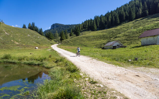
Al cospetto di Cima Portule - Facing Cima Portule - Im Angesicht von Cima Portule

Group of itineraries

Facing Cima Portule

  • Description
  • Additional information
Description

Description

Ideal: by bike
Length: 37,7 km
Average duration: 04:01
Difference in elevation: 1.280 m
Difficulty: difficult
Data collected through Komoot App, “MOUNTAIN BIKING” mode
Starting point/Arrival: Ghertele (Parking)
Recommended direction: clockwise
Ideal season for trekking: from June to October (without snow)


Starting point at Ghertele locality. Continue along the Costo Provincial Road until you reach the fork for Larici locality. Turn right up to the Malga Larici fork. Turn right and continue along the dirt road that passes behind the malga, cuts at a hight the slope of Cima Portule slope and takes you to Bocchetta Portule. Once you’ve gone through the little mountain pass, go downhill to Monumenti locality and follow the directions for Campo Gallina. Pass by the remains of the citadel and continue uphill until you reach Selletta Mecenseffy, the highest point of the trail (2055 m); once you’ve passed it, continue to the next two forks (Bivio Italia and Bivio Conrad) where you will keep to the right and then go downhill to Malga Galmarara. Once you have passed the malga, continue downhill passing over Malga Galmararetta and arriving again to the Provincial Road. Turn right to return to the starting point.

It is possible to shorten your travel time by cutting through Bivio Monumenti. Here, turning right and following the Zoviellostrasse trail, you can quickly reach Malga Galmarara.


Additional information

Additional information

Plateau area/s

Larici – Portule

Discipline

Ideal by bike

Difficulty

Difficult

Length (by bike)

over 30 km

Difference in elevation (by bike)

over 1000 m

General information and news

The itinerary, particularly popular with expert cyclists, runs through the highest part of the Plateau and is characterized by vast expanses of dwarf pine groves, high altitude pastures, and many sections of road closed to vehicle traffic. Thanks to the dirt roads made by the Austro-Hungarian army during the first World War, the route goes through some of the most remote and beautiful areas of the Plateau which, considering the high altitude and the distance from inhabited centers and food points, should be tackled with due awareness. Along the entire high part of the itinerary, commemorative plaques to the Great War can be found, including those concerning Selletta General Von Mecenseffy (small pass).
Just after Monumenti locality, taking the small road to the left heading north, you can reach the malga located at the highest altitude of the entire Plateau: Malga Portule Pastorile – Casara Trentin (almost 2000 m), at the foot of Cima Portule.
Furthermore, from Malga Larici di sotto and Malga Galmarara, various excursions on Cima Portule, Cima XII, and the entire high part of the Plateau begin.


A shorter variation can also be taken, decreasing the difficulty of the itinerary both in terms of the difference in level and in terms of the duration (about 45 minutes shorter), turning right at the crossroads of Monumenti locality and travelling close to Malga Portule, then re-joining the itinerary near Malga Galmarara (travelling on the Zoviellostraße, on Monte Zoviello).


Other sites of interest along the route:

  • After Ghertele locality, along Val Renzola, are some collection points of the Aqueduct: the springs are here (rare on the Plateau, since it is karstic) which were used during the Great War to provide water to the divisions of the Austro-Hungarian army. In fact, the water was pumped to the Bocchetta Portule accumulation reservoirs, dug entirely into the rock (to the altitude of 1937 m after a difference in level of about 800 m), and subsequently utilized using a complex distribution system.
  • Bocchetta Portule, an important point of passage in the Austro-Hungarian arterial road of the First World War, between Val Renzola and Valle del Portule, which led from Piana di Vezzena to Campo Gallina. Near the opening, two enormous slits can be seen in the mountain, used first by the Italians as cannon posts and then by the Austrians as covered passage for a cableway that took munitions and provisions to Campo Gallina. There is a small rest area here with illustrative notice boards.
  • Campo Gallina: this is one of the most interesting sites of the Ecomuseo della Grande Guerra Prealpi Vicentine, with numerous signs of what was the main Austro-Hungarian logistics center in the northern part of the Plateau, so much that it is called “the city between the mountains”. Thousands of soldiers were posted here, so everything that was needed for survival at these altitudes was constructed (a small church, a theater, parking for vehicles, etc.).


Mountains in the area: Cima Larici, Cima Portule, Cima XII, Monte Forno, Corno di Campo Verde, Corno di Campo Bianco, Cima dell’Arsenale, Monte Zingarella.

Photos, videos, tourist spots in the surrounding areas

Find out more

Tips for making the most of the trail

Ideal: by bike
Length: 37,7 km
Average duration: 04:01
Difference in elevation: 1.280 m
Difficulty: difficult
Data collected through Komoot App, “MOUNTAIN BIKING” mode
Starting point/Arrival: Ghertele (Parking)
Recommended direction: clockwise
Ideal season for trekking: from June to October (without snow)


Starting point at Ghertele locality. Continue along the Costo Provincial Road until you reach the fork for Larici locality. Turn right up to the Malga Larici fork. Turn right and continue along the dirt road that passes behind the malga, cuts at a hight the slope of Cima Portule slope and takes you to Bocchetta Portule. Once you’ve gone through the little mountain pass, go downhill to Monumenti locality and follow the directions for Campo Gallina. Pass by the remains of the citadel and continue uphill until you reach Selletta Mecenseffy, the highest point of the trail (2055 m); once you’ve passed it, continue to the next two forks (Bivio Italia and Bivio Conrad) where you will keep to the right and then go downhill to Malga Galmarara. Once you have passed the malga, continue downhill passing over Malga Galmararetta and arriving again to the Provincial Road. Turn right to return to the starting point.

It is possible to shorten your travel time by cutting through Bivio Monumenti. Here, turning right and following the Zoviellostrasse trail, you can quickly reach Malga Galmarara.


WOULD YOU LIKE TO USE THE GPS NAVIGATOR?​

Download .GPX

The circular route track is available in .gpx format as well
> Find out more about how to use GPS tracks

> E-bike recharge stations – Rental and purchase spots for bikes, e-bikes, clothing and equipment

Possible customizations and alternate starting points​

  • The proposed itineraries are planned in a circular fashion, thus the starting point coincides with the destination point.
  • The travel direction indicated here is recommended based on the itinerary’s altitude and to facilitate the overall panoramic view.
  • In case of customizations, we recommend you check the changes in parameters regarding the length, travel time and the altitude differences, as well as to ascertain the actual practicability of the trails that are not mentioned here.

This itinerary is easily accessible by following an approaching path from the center of the Seven Municipalities of the Altopiano or from particularly convenient points due to their geographical position or services offered.

Alternative starting points/arrivals in the area:

Valle di Galmarara fork, Asiago.

Malgas that can be reached during the itinerary

We recommend to checking the periods when the services offered by the malgas are available (usually June-September, but with varying dates)

Along the trail/nearby:

Malga Larici di sotto

Codice ID: 1

Attività e servizi: 

Summer pasturing
Milking
Cheese-making
Production/sales of malga products
Food/drink service
Event planning
Families with children welcome

Scopri di più
Malga Galmarara Pastorile

Codice ID: 8

Attività e servizi: 

Summer pasturing

Scopri di più
Malga Galmarara

Codice ID: 7

Attività e servizi: 

Summer pasturing
Food/drink service
Overnight stay
Families with children welcome

Scopri di più
Malga Galmararetta

Codice ID: 6

Attività e servizi: 

Summer pasturing
Food/drink service (with sheep milk products)
Families with children welcome

Scopri di più

Reachable with a brief detour:

Malga Portule

Codice ID: 10

Attività e servizi: 

Summer pasturing

Scopri di più

In the area but off the trail:

Malga Portule Pastorile (Casara Trentin)

Codice ID: 9

Attività e servizi: 

Summer pasturing

Scopri di più
> SEE OTHER ITINERARIES IN THE SAME AREA
> SEARCH ITINERARIES WITH OTHER FEATURES

MAP with all itineraries

Download

E-bike recharge – Rental and purchase spots

Find out more
  • Home
  • The project
  • Press conference and Press kit
  • Malgas
  • Itineraries
  • Contacts
  • Home
  • The project
  • Press conference and Press kit
  • Malgas
  • Itineraries
  • Contacts

Initiative financed by the Veneto rural development program 2014-2020
Authority responsible for information: Unione Montana Spettabile Reggenza dei Sette Comuni
Managing authority: Regione del Veneto – Direzione AdG FEASR Bonifica e Irrigazione

logo_reggenza2
regione-veneto
GAL_500
Facebook Instagram Youtube

© Unione Montana Spettabile Reggenza dei Sette Comuni ASIAGO ENEGO FOZA GALLIO LUSIANA CONCO ROANA ROTZO
Piazza Stazione – 36012 Asiago (VI) – All rights reserved – Cookie Policy | Privacy Policy | Website by Veneto Marketing

Go to Top