Skip to content
La Via delle Malghe | Altopiano dei Sette Comuni
#sweethomealtopiano
La Via delle Malghe | Altopiano dei Sette ComuniLa Via delle Malghe | Altopiano dei Sette Comuni
  • Home
  • Project
    • The project “The Malga Trail”
    • Press conference and Press kit
    • The Malga: history, environment, territory, management
    • Tourist accomodations in the Malga: good practices
    • Orientwalking among the malgas
    • Interview with Gianbattista Rigoni Stern
  • Malgas
  • Itineraries
    • All itineraries
    • A | Between Biancoia and Monte Corno
      • A1 | Val Biancoia and surrounding areas
      • A2 | Bertiaga – Valle Camporossignolo – Valle Granezza di Gallio – Monte Corno
      • A3 | Monte Corno – Campo Rossignolo
    • B | The Three Mountains
      • B1 | Cima Ekar – Monte Valbella – Bertigo – Turcio
      • B2 | Valbella – Cima Ekar
    • C | Melette of Foza and Gallio
      • C1 | Trail around Melette of Foza and Gallio by bike
      • C2 | Melette of Foza walking trail
    • D | Piana di Marcesina, Valmaron and Ortigara
      • D1 | Valmaron – Marcesina – Lozze – Fiara
      • D2 | Marcesina – Lozze – Fiara
      • D3 | Valmaron and Marcesina with road bikes
      • D4 | Valmaron – Forcellona – Marcesina
    • E | Along the ridge of Longara
      • E1 | Longara and Campomulo
    • F | Monte Zebio, in the heart of the Plateau
      • F1 | Forte Interrotto – Val Galmarara – Zingarella – Zebio – Val di Nos
      • F2 | Zebio and Zingarella
    • G | Facing Cima Portule
      • G1 | Larici – Portule – Galmarara
    • H | The high pastures of Larici
      • H1 | Val Formica, Dosso and Porta Manazzo
    • I | On the slopes of Monte Verena
      • I1 | Roana Lake – Verena – Campolongo
      • I2 | Monte Verena trail
      • I3 | Ghertele Ecological Museum
      • I4 | Rotzo Malgas trail
    • L | A window onto the plain
      • L1 | Asiago – Val Magnaboschi – Monte Paù – Monte Corno
      • L2 | Buse di Carriola – Bocchetta Paù – Foraoro
    • Other itineraries on the Plateau: the “Alta Via della Grande Guerra”
  • Services
    • Tourist information
    • E-bike recharge – Rental and purchase spots
    • Winter sports
    • GPS route
    • Webcam
  • Contacts
  • Italian
  • German
  • Home
  • Project
    • The project “The Malga Trail”
    • Press conference and Press kit
    • The Malga: history, environment, territory, management
    • Tourist accomodations in the Malga: good practices
    • Orientwalking among the malgas
    • Interview with Gianbattista Rigoni Stern
  • Malgas
  • Itineraries
    • All itineraries
    • A | Between Biancoia and Monte Corno
      • A1 | Val Biancoia and surrounding areas
      • A2 | Bertiaga – Valle Camporossignolo – Valle Granezza di Gallio – Monte Corno
      • A3 | Monte Corno – Campo Rossignolo
    • B | The Three Mountains
      • B1 | Cima Ekar – Monte Valbella – Bertigo – Turcio
      • B2 | Valbella – Cima Ekar
    • C | Melette of Foza and Gallio
      • C1 | Trail around Melette of Foza and Gallio by bike
      • C2 | Melette of Foza walking trail
    • D | Piana di Marcesina, Valmaron and Ortigara
      • D1 | Valmaron – Marcesina – Lozze – Fiara
      • D2 | Marcesina – Lozze – Fiara
      • D3 | Valmaron and Marcesina with road bikes
      • D4 | Valmaron – Forcellona – Marcesina
    • E | Along the ridge of Longara
      • E1 | Longara and Campomulo
    • F | Monte Zebio, in the heart of the Plateau
      • F1 | Forte Interrotto – Val Galmarara – Zingarella – Zebio – Val di Nos
      • F2 | Zebio and Zingarella
    • G | Facing Cima Portule
      • G1 | Larici – Portule – Galmarara
    • H | The high pastures of Larici
      • H1 | Val Formica, Dosso and Porta Manazzo
    • I | On the slopes of Monte Verena
      • I1 | Roana Lake – Verena – Campolongo
      • I2 | Monte Verena trail
      • I3 | Ghertele Ecological Museum
      • I4 | Rotzo Malgas trail
    • L | A window onto the plain
      • L1 | Asiago – Val Magnaboschi – Monte Paù – Monte Corno
      • L2 | Buse di Carriola – Bocchetta Paù – Foraoro
    • Other itineraries on the Plateau: the “Alta Via della Grande Guerra”
  • Services
    • Tourist information
    • E-bike recharge – Rental and purchase spots
    • Winter sports
    • GPS route
    • Webcam
  • Contacts
  • Italian
  • German

Malga Busafonda-Campomulo

You are here:
  1. Home
  2. Malgas
  3. Malga Busafonda-Campomulo

Activities and services

Summer pasturing
Milking
Cheese-making
Production/sales of malga products
Food/drink service
Families with children welcome

– Mountain grazing is the uphill journey of the livestock to the Alpine pasture.

– It is recommended to check the website and social media profiles of the malga for updated activities and services.

Find out more about the malgas in the Plateau of the Seven Municipalities

Loc. Campomulo
Latitude: 45,930912 | Longitude: 11,560865
Plateau area/s:

  • Larici - Portule

The Malga Busafonda pastures also include those of the former Malga Campomulo, now converted into a mountain refuge and departure point for the Campomulo Cross-Country Skiing Center, one of the most beautiful and best-equipped in Italy, with over 100 km of trails winding through the pastures and forests.
The area dedicated to alpine grazing at Malga Busafonda covers the narrow strip of prairie in the Campomulo valley, which branches out into the side valleys and ski paths of the nearby lifts of Melette di Gallio. The pastures of the former Malga Campomulo include a large hollow enclosed between Monte Fiara to the north, Monte Sbarbatal to the southeast and Monte Baldo to the southwest.
During the winter there is also a speed skating track open near Malga Busafonda.
The pastures of the malga located in the Campomuletto hollow are crossed by the “Trail of Silence – Door of Memory”, a must for many tourists.

Competent body:

Comune di GALLIO
ID code
Altitude (m)
Surface area (ha)
Livestock
LSU no.
Pasture
Woods
Ponds
ID code
14
Altitude (m)
1500
Surface area (ha)
119,44
Livestock
Cows
LSU no.
100
Pasture
Festucas
Woods
Spruce forest, beech trees
Ponds
6

Find out more about the meanings of technical words used here

How to get there

From the center of Gallio, go towards Foza on the S.P. 76 for about 500 m. At the fork for Campomulo turn left and continue for about 5.4 km until you see the malga on the right.
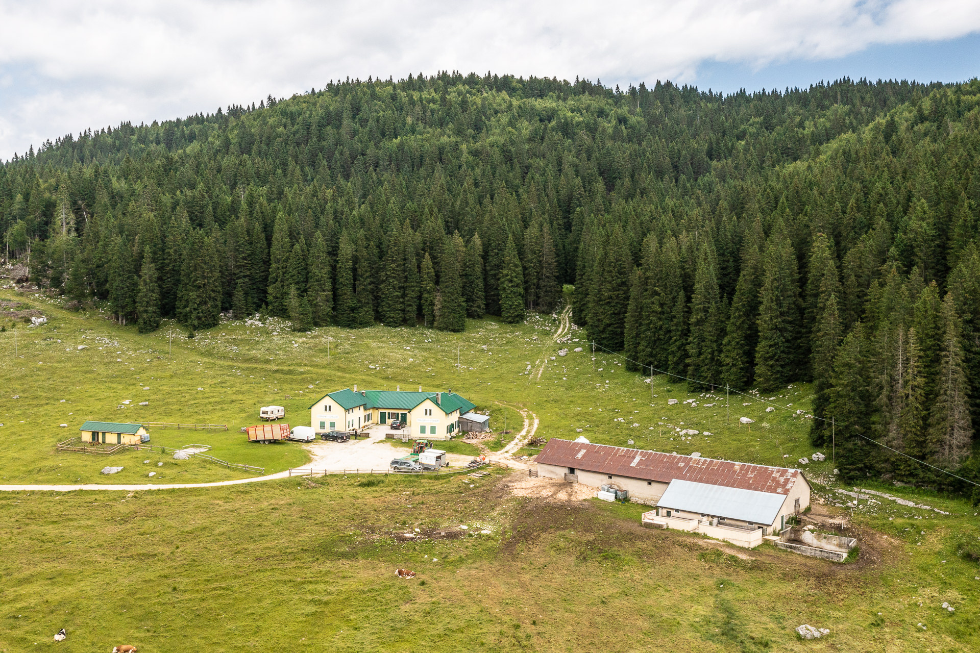

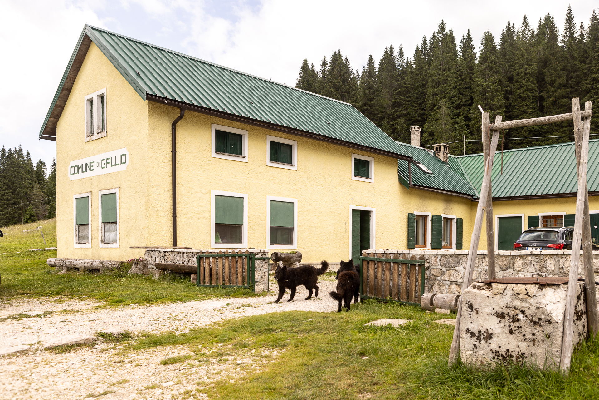
Malga Busafonda-Campomulo


Malga Busafonda-Campomulo


Inserted in itineraries:

E1 | Longara and Campomulo

E1 | Longara and Campomulo

Do you want to have the best experience in the malga?

malghe-icone-esperienza_4

When you arrive at the malga, you’re entering the “home” of the malga operator population and their livestock: It’s a welcoming environment, rich with fascination, everything is to be discovered but also respected. Here are our recommendations for you!

How’s life in the malga

The malga operator lifestyle is characterized by hardwork that starts before dawn and continues even after sundown. For example…Did you know that there two times set apart for milking? One before breakfast and another in the late afternoon.

Also, feel free to ask information but avoid going into work areas inaccessible to the public and be discrete: speaking too loudly may scare the livestock and disturb whomever is enjoying the peace of the mountain.

The cows: how to safely get close

They are passive and docile animals but their size could put you in uncomfortable situations…or somewhat inappropriate behaviors could frighten them and provoke dangerous and unusual reactions.
It’s enough to maintain an adequate distance, avoid taking pictures from too close up, touching them, bothering them or looking them directly in the eye.

If you are with your dog, remember to keep it on a leash and under control.
When you find yourself near some cows, it’s better to avoid sudden movements, walk slowly and without getting anxious. And, if they were to get too close, distance yourself calmly and without turning your back to them!

The malga operators’ dogs

They watch over the livestock and often offer a warm welcome to guests. Don’t worry: They are not dangerous. Treat them with respect and you will become good friends. If you are on a bike, slow down to avoid mean falls caused by demonstrations of affection a little too… overwhelming!

Waste management

Those who follow the itineraries and visit the malgas know well how wonderful nature is, with its breathtaking landscapes. This is the reason why it is important not to pollute it with waste that can be taken home and properly recycled or disposed of.
The herdsmen of the plateau and the animals that live there are very fond of tourists who enjoy the wonderful days with walks, fresh air and relaxation… respecting the woods and pastures!!

See all malgas
  • Home
  • The project
  • Press conference and Press kit
  • Malgas
  • Itineraries
  • Contacts
  • Home
  • The project
  • Press conference and Press kit
  • Malgas
  • Itineraries
  • Contacts

Initiative financed by the Veneto rural development program 2014-2020
Authority responsible for information: Unione Montana Spettabile Reggenza dei Sette Comuni
Managing authority: Regione del Veneto – Direzione AdG FEASR Bonifica e Irrigazione

logo_reggenza2
regione-veneto
GAL_500
Facebook Instagram Youtube

© Unione Montana Spettabile Reggenza dei Sette Comuni ASIAGO ENEGO FOZA GALLIO LUSIANA CONCO ROANA ROTZO
Piazza Stazione – 36012 Asiago (VI) – All rights reserved – Cookie Policy | Privacy Policy | Website by Veneto Marketing

Go to Top